|
Get ready for
hurricane season
A mild storm forecast
does not change the need
to stock up, experts warn
Just because a below-average hurricane season is predicted this year for Hawaii does not mean the public can let its guard down, hurricane experts say.
STORM BASICS
How to prepare for a hurricane:
» Everyone should learn evacuation routes and shelter locations.
Source: National Oceanic & Atmospheric Administration
|
"Even if only a single hurricane forms and moves all over the islands, it could cause devastation and possibly loss of life," Weyman said.
Hurricane experts predicted two to three tropical cyclones for Hawaii and the Central Pacific, a below-average hurricane season that officially begins June 1 through Nov. 30.
Typically, four to five tropical cyclones -- a hurricane, two tropical storms and one or two tropical depressions -- occur yearly in the Central Pacific.
"I know another hurricane will hit Hawaii. But we can't say it's going to be this year or 10 years from now. But it's because of that uncertainty that we have to plan every year, because we don't know when that year will come," Weyman said.
Last year, three tropical cyclones -- a tropical storm and two tropical depressions -- occurred in the Central Pacific. Weyman noted that the main threat of tropical cyclones occurs in July, August, September and the early part of October.
Many people who have moved to the islands since Hurricane Iniki struck in 1992 have not experienced the devastation of hurricanes, he added.
Weyman also said new residential developments built near shorelines, on ridgelines and in flash-flood areas are susceptible to hurricane conditions.
"I still believe the vast majority of the public is not prepared," he said.
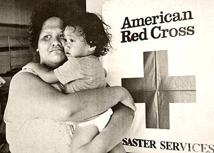
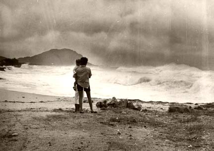
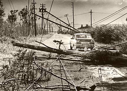
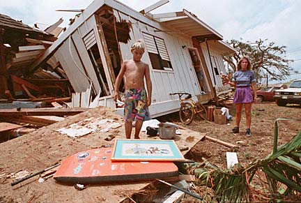
HAWAII'S 3 BIG HURRICANES

|

|

|
Kaya said he now prepares for storms and hurricanes by purchasing food and phone cards. He said he regularly visits Web sites such as one run by the Federal Emergency Management Agency to get tips on preparedness, and is attentive to local media advisories.
While the Central Pacific is predicted to have a below-average hurricane season, National Oceanic and Atmospheric Administration officials anticipate another above-normal hurricane season in the Atlantic.
The Atlantic is forecast to have "12 to 15 tropical storms, with seven to nine becoming hurricanes, of which three to five could become major hurricanes (with winds in excess of 111 mph)," said retired Vice Adm. Conrad Lautenbacher, undersecretary of commerce for oceans and atmosphere and NOAA administrator.
"Forecaster confidence that this will be an active hurricane season is very high," Lautenbacher said.
The Atlantic has seen above-average hurricane activity almost every season since 1995 with the warming of ocean water.
This year, hurricane experts in Honolulu are testing an experimental tool that conveys the threat of tropical systems in the Central Pacific.
A graphic on the NOAA Web site will display "wind speed probabilities based upon uncertainties associated with the official tropical cyclone forecast track, intensity and wind structure."
"It's not necessarily the center of the storm that's going to cause the damage; it's the winds," said Andy Nash, science and operations officer at the Central Pacific Hurricane Center.
Nash said the purpose of the graphic is to focus on the size of the storm rather than the location. He said he hopes the graphic and text will be an additional tool for civil defense officials and the public to help prepare for a hurricane.
Officials are asking for the public's feedback on the new graphic at www.prh.noaa.gov/cphc/pages/probwinds.php.
www.prh.noaa.gov/hnl/cphc/
Tropical Storm Tracker
www.solar.ifa.hawaii.edu/Tropical/tropical.html
[News] [Business] [Features] [Sports] [Editorial] [Do It Electric!]
[Classified Ads] [Search] [Subscribe] [Info] [Letter to Editor]
[Feedback]
