

Ewa Plain
residents gain a
playground
The Kalaeloa Community
By Pat Omandam
Development District has much
to offer to the public
Star-BulletinAs a real estate agent, John Riggins sees the closure of Barbers Point Naval Air Station as an economic setback for the unfolding Kapolei area, which also hurts a slumping housing market on the Ewa Plain.
But as a resident and current president of the Villages of Kapolei Association, Riggins knows the 2,400 families there will enjoy what Kalaeloa has to offer to the public.
"I think in the short term it is probably a bad thing," Riggins said. "In the long term, as people utilize the Barbers Point Air Station, it will be a benefit to the entire community."
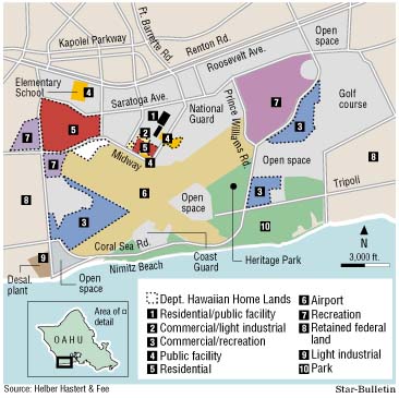
With the opening of the Kalaeloa Community Development District today, 1,007 of the roughly 3,700 acres will be kept by the Navy for military housing and support services while 491 acres goes to other federal agencies, including the Hawaii Army National Guard, the U.S. Fish and Wildlife Service and the U.S. Coast Guard.
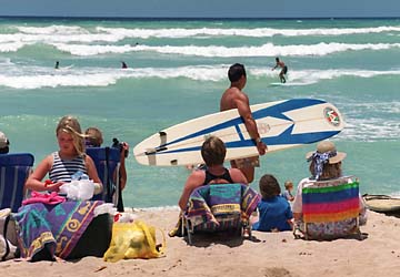
The remaining 2,153 acres of the surplus Navy land is being transferred to state and city agencies, which has created excitement because residents of Oahu's second city now have a true playground, said Maeda Timson.That playground has been described as large as the land between Middle Street and Manoa, with a beach twice as long as Waikiki Beach.
"The beaches will be open to the public, which they have never been, and the residents from the area -- all the way from Ewa Beach down to Waianae -- will be able to use the roads that connect Ewa Beach to Kapolei," said Timson, chairwoman of the Makakilo/Kapolei/Honokai Hale Neighborhood Board.
"To me, that's the big thing," she said.
The largest new landowner at Kalaeloa is the state Department of Transportation, which assumed ownership of 750 acres of air traffic control tower, hangars and runways today under a new name -- Kalaeloa Airport. Its users are small private and commercial airplanes, the U.S. Coast Guard and the Hawaii National Guard, which is under contract by the department to have guardsmen help with air traffic operations.
Tom Funkhouser, chief of air traffic control operations at Kalaeloa, said refurbishment of the existing tower will take five months. In the meantime, guardsmen will operate the airport from a mobile tower used for field training. Funkhouser said nine civilians and five guardsmen will manage air traffic once work is completed.He expects to handle between 150,000 and 200,000 flight operations a year at the airport.
Prime acquisition
While the Transportation Department got the most land, the Department of Hawaiian Home Lands got the most with economic potential. As part of the 1995 federal Hawaiian Homes Recovery Act, the department received 546 acres of land scattered on a dozen parcels at Kalaeloa.Hawaiian Homes planning administrator Darrell C. Yagodich said 143 acres of the 546 is designated for homesteads, but most of it is next to Campbell Industrial Park and may be unsuitable for homes. With residential homesteads planned in the Village of Kapolei and in Ewa, Yagodich said the primary use of the Kalaeloa lands is to generate income, with an eye toward helping native Hawaiian entrepreneurs.
"Part of our mission is to assist the beneficiaries in developing their business potential, so you have some of that here," he said.
Yagodich noted the state's $30 million-a-year settlement with the department over use of public trust lands ends in 15 years and these lands provide the opportunity to at least replace that income. He's optimistic the department can lease its hundreds of commercial and light industrial lands, despite slow industrial growth on the island.
"You don't have too many situations where you have this much acreage near an airport, near a harbor, in an area that is heavy industrial," he said. "It has a lot of features."
Also, the department has proposed an auto raceway complex, a festival center and a marine park on 277 acres in Kalaeloa. The raceway is different from that planned for the Hawaiian Super Prix this November.
Yagodich cautioned that the department still must conduct feasibility studies and improve infrastructure on its new properties before they can be leased.
Big responsibility
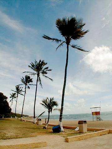
Meanwhile, one of the biggest headaches at Kalaeloa is management of 186 acres of pristine shoreline property that includes 2 miles of white sand beaches and forests of ironwood trees. The land is part of the 483 acres given to the city of Honolulu for parks, a sport complex, campsites and maintenance facilities.These isolated beaches are used heavily by military personnel on weekends. The Navy will retain and upkeep beach-front facilities at the White Plains and Nimitz beaches, but the city is now responsible for the rest, and will have to provide trash and beach cleanup, permits for camping, parking and signs.
Parks staff are stretched thin just maintaining the existing parks and some question how the city will cope with the immediate addition of nearly 500 acres of parkland. The city, however, is not deterred.
"We will maintain what we need to maintain," countered city Parks Director Bill Balfour. "We will keep it clean to the extent that we need to."
Balfour said he needs to see how much usage the beaches will get before he can decide how much maintenance is needed. The 13 campsites at Kalaeloa have been added to the computerized city park system and permits for the Fourth of July weekend there are all filled, said City Transportation Services Director Cheryl Soon, vice chairwoman of the Barbers Point Naval Air Station Redevelopment Commission.
"Our highest priority is to make the ocean accessible to the people," Soon said.Another big problem at Kalaeloa is security. The district is public property and there is no way to stop anyone who wants to visit, said commission Executive Director Bill Bass. The state commission oversees the 20-year development of the district.
Bass said the public can enter Kalaeloa from Fort Barrette Road in Kapolei and from Geiger Road in Ewa. Plans are for hired security guards paid for by the landowners to monitor the front and back gates, but they will not stop anyone.
Any suspicious activity will be reported to police, he said.
"Well, we're going to try and discourage them from going into the Navy housing area, but that's about the limit," Bass said.
"There are some roads that lead into some really desolate places. We might chain those for a while -- more to keep people from wandering off lost and never coming back," he said.
Bass said the state airport, the Coast Guard and the Navy will provide roving patrols for their properties. There is an agreement to assist one another during emergencies, he said.
Meanwhile, an additional 12 acres of land is going to the state Housing and Community Development Corp. of Hawaii for homeless assistance. The lands and former barracks will allow the state to increase transitional housing on Oahu by one third.
As planned, the site also would provide laundry and health facilities, a food bank, day-care center, an employment office and career counseling.
Hawaiian names
sought for streets
A commission member says
By Pat Omandam
changes would instill pride
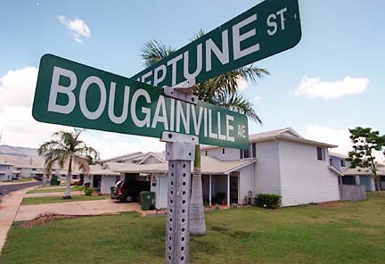
Star-BulletinThe streets of the former Barbers Point Naval Air Station could soon have Hawaiian names.
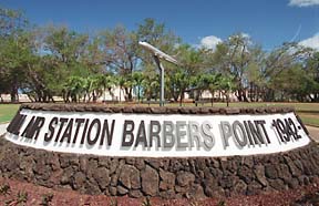
Maeda Timson, a member of the Barbers Point Naval Air Station Redevelopment Commission, believes the names of the streets now under civilian control at Kalaeloa should conform with a 1979 city ordinance that requires a Hawaiian street name for new streets.
Timson said renaming the streets would culminate six years of work to prepare the military base for civilian control. It also will focus attention on the future of the district, not just on its military past. She's suggesting a committee of city officials, kupuna, Hawaiian Civic Club members, community officials and others convene to discuss proper Hawaiian names relative to the region.
For example, she would like to see Fort Barrette Road -- the main artery that leads to the front gate of the former base -- renamed Pu'u Kapolei, to emphasize the volcanic cylinder that looms in the area.
Kalaeloa, which means long cape or headland, is the legendary birthplace of Hawaiian kings.
"Again, by putting this committee together and including the community in this process, you instill community pride and ownership in the area," Timson said.
Street names given at Barbers Point are of Naval ships or battles.
For example, the streets along the perimeter of the 3,700-acre property are named Franklin D. Roosevelt, Essex, Tripoli, Coral Sea and Saratoga.
Commission Executive Director Bill Bass said there has been no action to change the street names because there is a big difference of opinion on the commission on what to do.
There are about 50 streets under the commission's control. The issue probably will come up again at the commission meeting next month, he said.
City Parks Director Bill Balfour, the city's point man on the base closure, said he has heard talk of changing street names at Kalaeloa, but that's all.
The city must also decide what names, if any, to give to the beaches and campsites under its control within the district.
Timson, also chairwoman of the Makakilo /Kapolei/ Honokai Hale Neighborhood Board, said the commission has the greatest respect for the military and would not endorse any name changes on streets that remain under federal control.
She said the idea has been talked about for years but was put on the back burner by commissioners until more pressing turnover issues were addressed.
Here is a breakdown in acres of ownership at the Kalaeloa Community Development District, according to the Barbers Point Naval Air Station Redevelopment Commission: Who owns what
1,498: Lands the Navy retains control over.
2,153: Lands released to the state and county.
3,651: Total acres.
Navy lands:
1,007: U.S. Navy.
239: U.S. Fish and Wildlife Service (open space/refuge).
145: Hawaii Department of Defense.
43: U.S. Coast Guard (air station).
34: Defense Reutilization Materials Office.
21: Federal Aviation Authority (navigation beacon).
7: Veterans Administration.
1: U.S. Postal Service (post office).
3/10 of an acre: West Oahu Community Federal Credit Union.
State and county lands:
750: State Department of Transportation (airport).
546: State Department of Hawaiian Home Lands.
483: City Department of Parks and Recreation.
176: Roads and open space.
135: State Department of Land and Natural Resources (historic sites).
31: City Board of Water Supply (desalination plant).
14: State Department of Education (elementary school).
12: State Housing and Community Development Corporation of Hawaii (homeless facilities).
6: University of Hawaii (aviation training).
Here are some questions and answers regarding the closure of Barbers Point Naval Air Station. Things to know about
the transitionQuestion: What is the area's new name and purpose?
Answer: The former base opens today as the Kalaeloa Community Development District, governed by the Barbers Point Naval Air Station Redevelopment Commission. More than 2,100 acres of state land is planned for various uses, including a general aviation airport, beaches, parks, homesteads and a raceway track, as well as commercial and light industrial businesses.
Q: Can I enter Kalaeloa without a permit or pass?
A: Yes. Plans are for security guards at the front gate of Fort Barrette Road and the back gate on Geiger Road in Ewa to monitor traffic.
The guards, however, will not stop anyone from entering, said Bill Bass, commission executive director.
Q: Will the public have access to the beach areas of Kalaeloa?
A: Yes. There are 2 miles of white sand beaches open to the public. The Navy, however, will retain control of beach cabins, rest rooms and restaurants at Nimitz Beach and White Plains Beach. Public access there will be from 6 a.m. to 9 p.m.
Dozen of campsites along the beach will be under city jurisdiction.
Q: Will the public have use of military facilities remaining in Kalaeloa?
A: No. The Navy housing area and its support facilities such as the exchange, bowling alley, medical clinic, chapel and golf course are restricted to military personnel and their families.
But open to everyone at Kalaeloa are fast-food restaurants such as McDonald's and Subway.
Q: Will there be security at Kalaeloa?
A: Yes. The Department of Transportation, the Coast Guard and the Navy will provide roving security guards for their properties. Plans are for other landowners to contribute money to pay for gate security.
The Honolulu Police Department will respond to calls within Kalaeloa, which falls under its Kapolei District patrol, but there will be no officers stationed within the district.
Q: Will general traffic be allowed to drive through the district for motorists who want to get from Ewa Beach to Kapolei or vice versa?
A: Yes. The opening of Kalaeloa has opened a "shortcut" from Geiger Road in Ewa Beach to Fort Barrette Road in Kapolei. It offers a third route for motorists who don't want to drive on Farrington Highway or t¡he H-1 Freeway.
Q: Can I go anywhere within Kalaeloa?
A: People can roam the district but some roads may be temporarily closed because the area is so large, Bass said. Also, the general aviation airport, historic and endangered sites and the Coast Guard Air Station will be gated off.
By Pat Omandam, Star-Bulletin