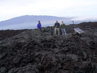
COURTESY PHOTO
Ben Brooks, left, David Phillips and James Foster stand by a continuously operating GPS station on Mauna Loa's northeastern rift zone.
|
|
Contra-flow lava data
New facts counter a prediction about Mauna Loa's next eruption
HILO » A new theory about magma accumulation inside Mauna Loa is giving Hawaii geophysicists food for thought, but it is no substitute for the moment-by-moment monitoring they are already doing, they say.
Geophysics professor Falk Amelung at the University of Miami published a paper in Science magazine this week saying satellite radar data from 2002 to 2005 showed magma accumulating under the south side of Mauna Loa. This would increase the probability of an eruption that might threaten the South Kona or Kau districts, the paper suggested.
But a team of scientists from the University of Hawaii at Manoa and the Hawaiian Volcano Observatory said newer data since 2005 indicates the danger of an eruption is decreasing.
"Since March 2005, (the southwest rift of Mauna Loa)* has not been expanding. It has been contracting," said Manoa geophysicist Ben Brooks, "but the summit of the mountain continues to inflate slowly."
They are also not confident that a Kona-side eruption is more likely than on the Hilo side.
It is "slightly" more likely that an eruption would head toward Kona or Kau, Brooks said. But the limits in Amelung's data leave him questioning that, he said.
At the Volcano Observatory, geophysicist Mike Poland also had doubts.
One way to find out whether Amelung is right is to wait for an eruption, Poland said. A better way is to gather information now.
That is what Poland, Brooks and James Foster have been doing. "We have built up an amazing archive of data," Poland said.
The information comes from satellite radar images, like Amelung's data. Unlike Amelung, they also use data from a network of global positioning system transmitters on Mauna Kea funded by the National Science Foundation.
The radar information has to be purchased from Canada, so scientists can generally only afford one image per month, Brooks said. In contrast, some of the GPS data come in a constant stream, literally second by second, Poland said. Other GPS data comes in once every 30 seconds.
In the last few hours before an eruption, or when one is under way, data from GPS instruments, a network of tiltmeters showing ground uplift, and most important, seismic data will be used to track an eruption, he said.
Despite their differences in viewpoints, the Hawaii scientists respect Amelung's work. "It's a good study," Brooks said.
A major difference between the two approaches is that Amelung goes beyond the Hawaii work in creating a theory that links a 1983 earthquake, the 1984 Mauna Loa eruption and the 2002-2005 Mauna Loa swelling. The 1980s events on the north side of Mauna Loa pushed more recent activity to the south side, Amelung believes.
The Hawaii scientists are watching to see if their data matches that.
CORRECTION
Tuesday, May 22, 2007
» The southwest rift of Mauna Loa has deflated since 2005, but the summit of the mountain continues to inflate slowly. A Page A5 story Saturday incorrectly quoted geophysicist Ben Brooks as saying the entire mountain has deflated. The story might also have given the impression that Brooks has an opinion about the likelihood of an eruption. Brooks did not make a statement about that.
|