
|
Civil Defense
given access to
satellite images
State Civil Defense officials now fly a helicopter to look for damage from natural disasters and to look for problems.
But helicopter surveillance could become a thing of the past now that the state Civil Defense agency has access to extremely detailed satellite images.
Maj. Gen. Bob Lee, who is head of both the Hawaii National Guard and the state Civil Defense agency, said a new $16 million satellite imagery system now at his disposal is so powerful that it can detect tiny oil leaks from small pleasure crafts.
The Eagle Vision 5 system, as it is called, was developed during the 1991 Gulf War and has been used to provide the military with real-time satellite imagery during the current conflict in Iraq.
Its war applications are obvious, but the Hawaii Air National Guard can now use the system to monitor island waters, Lee said.
And there are other potential uses. The Eagle system could help detect invasive plants, like miconia, or pinpoint locations where seaweed is clogging reefs and beaches, Lee said.
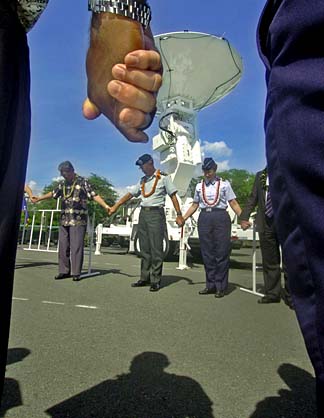
Yesterday, Lee was among the several hundred Hawaii Air National Guard, Air Force, politicians and technicians who attended the dedication of the military's Eagle Vision system, which is a portable ground station that can receive and process images captured from any one of seven commercial satellites.
Master Sgt. Reid Tsubota, Eagle Vision superintendent, said the system consists of three trailers, a 13-foot satellite dish, generators and air conditioning units, and everything fits neatly into an Air Force C-130 cargo plane.
And it takes four full-time technicians and 10 Guard members -- all assigned to the 293th Combat Communications Squadron -- to operate and maintain it.
Brig. Gen. (select) Kathleen Berg, Hawaii Air National Guard chief of staff, said Hawaii has one of the five Eagle Vision systems. Four are operated by the Air Force or the Air National Guard, and one by the Army.
"A sixth is planned for the Alabama Air National Guard," Berg said.
The first system, run by the Air Force, is stationed in Ramstein Air Base in Germany. The one operated by the Army is at Colorado Springs, Colo. The Air National Guard units are located in Nevada and South Carolina, with a third planned for Alabama, making them a key component in the war against terrorism and in homeland defense.
"That will mean that every nook and cranny of this country will be covered," Berg said.
Tech. Sgt. Jeremy Wadsack, data integration segment manager, said images collected from a commercial satellite are first transferred to a CD, DVD or tape.
The information can be used to produce products such as maps or identify different types of terrain as part of a battle planning process.
One of yesterday's demonstrations was a three-dimensional image of the area around Aloha Stadium and Pearl Harbor which could have been used by a fighter pilot to orient himself to the area.
"We just mainly pull down the data from the satellite," Berg added, "and turn it over to the intel (intelligence) people at PACAF (Pacific Air Forces), who process the images."
www.scd.state.hi.us/