
Forecasters warn El Niño
could produce drought
Mild El Niþo conditions in the Pacific Ocean mean a greater risk of hurricanes this fall, followed by less-than-average rainfall and more high surf this winter, Honolulu's chief National Weather Service meteorologist said yesterday.
"What the El Niþo often means for Hawaii is the threat of drought," Jim Weyman said at a briefing on the state's winter weather.
Weyman described drought as a "creeping danger, because it's not like a hurricane or a thunderstorm, which hits all of a sudden and then moves off."
Rainfall in most of the state was higher than average from January to September, Weyman said. But already farmers and ranchers on the Big Island and in East Maui are experiencing some hardship because of drier weather this summer, Weyman said.
El Niþo is a weather phenomenon created when sea-surface temperatures in the tropical Pacific Ocean remain at least 1 degree above average (from 77 to 81 degrees depending on the region of the Pacific) for three months in a row. El Niþo conditions tend to occur about every four to five years and can last up to 12 to 18 months.
The weather service announced last month that mild El Niþo conditions had developed.
In El Niþo years, Hawaii may experience "perfect tourist weather," Weyman said. "No clouds, no rain, always sunny except for a few afternoon thunderstorms."
Drought is a somewhat relative term, said Neil Fujii, drought coordinator for the state Commission on Water Resources Management. It is usually recognized sooner by agriculture and commerce and then by drinking water systems, and it ultimately causes greater risk of wildfires.
Plentiful rainfall the first half of the year helped grow plenty of trees, plants and grass, which when dried could become fodder for wildfires, said Kevin Kodama, a senior weather service hydrologist.
And while long-term predictions call for a drier winter, parts of the state could see heavy thundershowers tomorrow afternoon, Weyman said. The rain is unrelated to El Niþo, he said.
www.cpc.ncep.noaa.gov/products/analysis_monitoring/lanina
www.hawaiidrought.com
|
Graphic forecasts offered
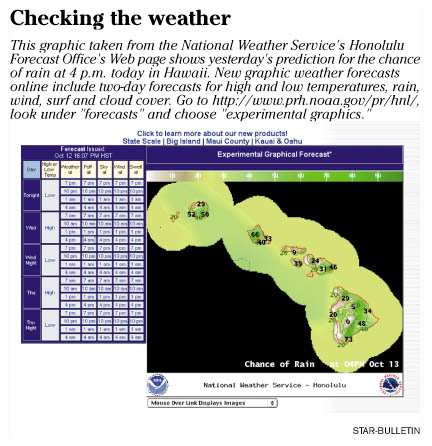
The Honolulu Forecast Office of the National Weather Service is now offering graphic versions of its three-day weather forecasts online.
Bright, color-coded maps of the state show predictions about daily high and low temperatures, rainfall, cloud cover, wind speed and direction, and the height and direction of open ocean swells. The graphics use the same data as written forecasts, but offer a more visual format.
Eventually, the office hopes to enhance the Web site so users can zoom in on one area of the state to get a more detailed view.
The new maps mean "you can get it (local forecasts) when you want it, where you want it," said Jim Weyman, meteorologist in charge of the Honolulu Forecast Office.