GRAPHIC BY KIP AOKI / KAOKI@STARBULLETIN.COM
Click image to return to story.
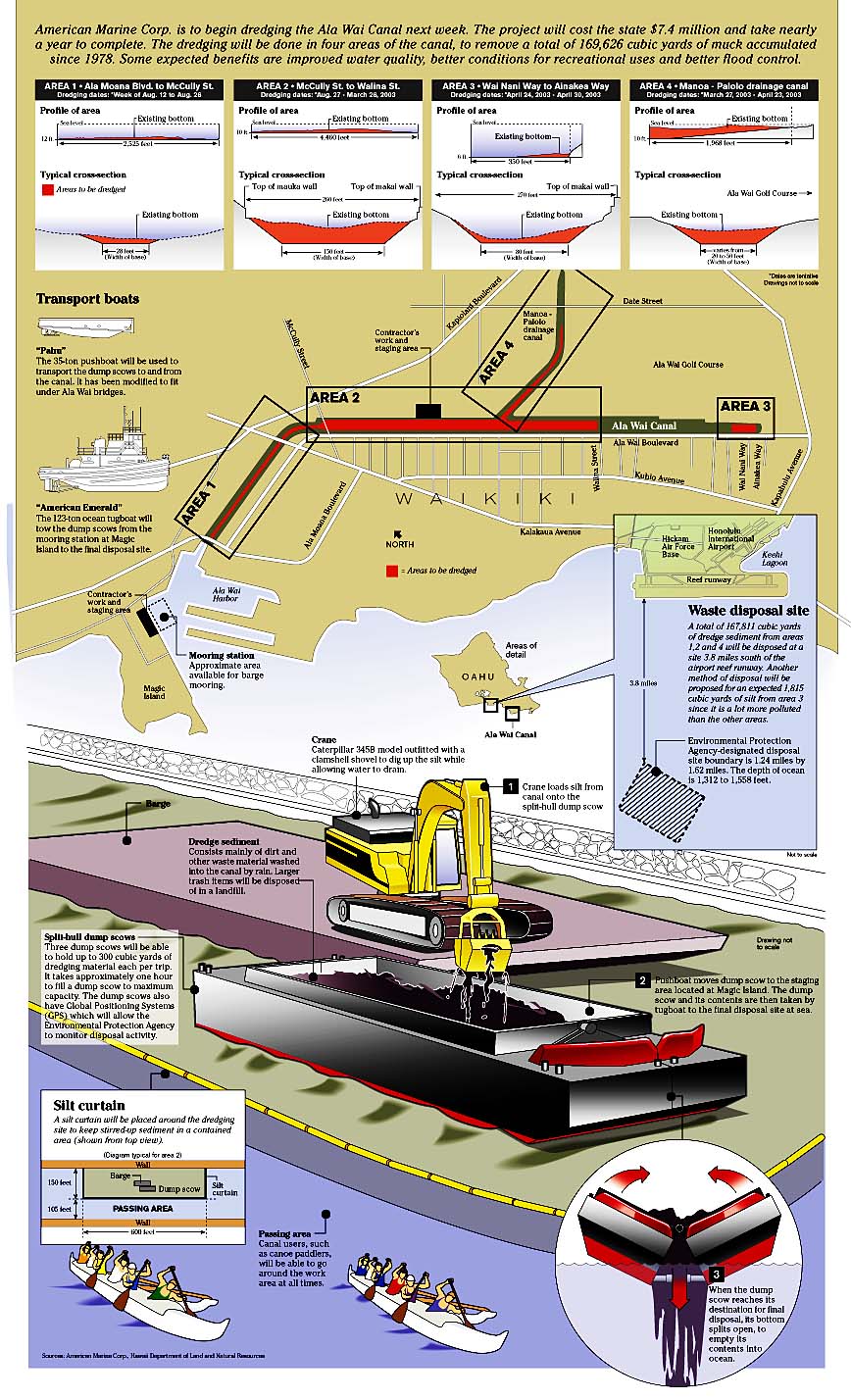
Canal completed: 1927. The scoop on the Ala Wai
Last dredged: 1978.
Dimensions: From Ala Moana to McCully bridges, 150 feet wide; from McCully to Manoa-Palolo Confluence, 250 feet wide; by Kapahulu Library, about 150 feet wide. Two miles long.
Drainage area for Ala Wai Canal: 16 square miles, of which one-third is conservation land and two-thirds is urban. Areas draining into the Ala Wai Canal are Manoa, Palolo, Makiki, Punchbowl, Tantalus, Moiliili, St. Louis Heights, Kaimuki, Kapahulu, Diamond Head, Ala Moana, Kakaako, McCully and Waikiki.
Streams feeding the Ala Wai: Manoa, Makiki, Palolo streams and their tributaries.
Annual sediment load into canal: About 8,000 to 10,000 cubic yards
Amount of dredge material to be removed: 169,626 cubic yards, or enough to cover a football field to a depth of 94.5 feet high.
Dredging work hours : 6:30 a.m. to 10:30 p.m. on weekdays.
Pollutants in the canal: Coliform bacteria (indicator of fecal matter); nutrients (fertilizers); sediment; pesticides; litter and garbage.
Pollutants that need special handling: Chlordane and lead, in the Kapahulu end of the canal.
Questions about the dredging?
American Marine Corp., job contractor: 545-5190State Department of Land & Natural Resources, public information office: 587-0330
Movement of boats: VHF channels 16 and 68.