
[ VOLCANO WATCH ]
What is the summit elevation of Mauna Loa? It's 13,677 feet, according to the 1994 Hawaii Volcanoes National Park brochure; 13,679 feet, according to the 1998 Atlas of Hawaii; and 13,678 feet on the 1996 Geologic Map of the Island of Hawaii. Who is right? Perhaps all? Internal changes affect
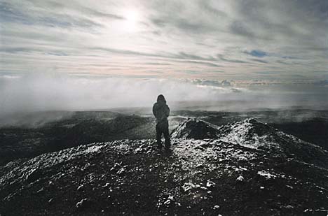
summit of Mauna LoaERUPTION UPDATE
By U.S. Geological Survey
Hawaiian Volcano ObservatoryLt. James King, on Cook's 1779 voyage, first calculated the elevation as 16,020 feet based on vertical angles to its summit from sea level.
Archibald Menzies, botanist with Vancouver's 1794 expedition, climbed Mauna Loa and estimated its elevation by barometer. On Feb. 6, 1794, Menzies and three other members of the expedition set out southward from Kealakekua Bay with Chief Luhea and 20 paddlers in a large double canoe belonging to King Kamehameha.
On Feb. 15, after more than a week of canoeing and overland adventures, Menzies and company arrived at 11,500 feet. The following are excerpts from his journal.
"We managed to boil the chocolate in a tin pot over a small fire made of our walking sticks, and each had his share of it warm, with a small quantity of rum in it, before we went to bed. ...
"As it was agreed we should all sleep together to keep ourselves warm, we joined together everything we had for our general covering, made pillows of the hard lava, and in this [way] was passed the night. ... Feb. 16. Next morning, at sunrise, the thermometer was at 26 degrees and the air was exceedingly keen and piercing. ... About 11 in the forenoon we arrived at the mouth of an immense crater. ... (We) crossed over this rugged hollow after a hard and persevering struggle, and by noon got to the highest part of the mountain, on the western brink of the great crater, where I observed the Barometer."
By previous agreement, barometric readings were also being made at Kealakekua Bay. Comparison of the two measurements allowed Menzies to calculate an elevation of 13,564 feet for the summit.
In 1885, J.M. Alexander measured vertical angles to the summit of Mauna Loa from several triangulation stations on the island. His calculations yielded an elevation of 13,675 feet. In 1926, Lt. L.G. Simmons ran a level line from Hilo to Mauna Loa's summit.
This difficult and tedious procedure involves carefully measuring points on the ground surface less than 10 feet apart in elevation using level rods and an optical level. Simmons' survey took nearly two months and provided the accurate result of 13,680 feet for Mauna Loa's summit elevation.
Level lines from Hilo to Volcano House run in 1912 and 1921 showed that the entire summit of Kilauea had increased in elevation by as much as 10 feet.
This confirmed suspicions, held by Thomas Jaggar (who founded the Hawaiian Volcano Observatory in 1912) and others, that the summits of active volcanoes rise and fall due to internal changes in volume or pressure of magma.
Geologists at the Hawaiian Volcano Observatory thought the summit area of Mauna Loa probably changed in a similar manner, but it was not until the volcano's 1975 and 1984 eruptions that this was proven.
During the year before the 1975 eruption, electronic distance measurements across Mauna Loa's caldera showed widening of about 4 inches, but information on elevation changes was not conclusive. Uplift of Mauna Loa, determined by level surveys in its summit area from 1977 to 1981, was at least 5 inches, and subsidence related to the 1984 eruption was at least 2 feet.
So how high is Mauna Loa? Somewhere near 13,675 to 13,680 feet. If you really want a precise answer, you also need to give the date on which an accurate measurement is made.
And is Mauna Loa presently rising or falling? It has been fairly stable over the past few years. But we expect it to swell before the next eruption.
This article was written by scientists at the U.S. Geological Survey's Hawaiian Volcano Observatory. The observatory can be mailed at P.O. Box 51, Hawaii National Park, HI 96718; by phone at (808) 967-7328; or by fax at (808) 967-8890.
Eruptive activity of Kilauea Volcano continued unabated at the Pu'u 'O'o vent during the past week. [ERUPTION UPDATE]
Lava flows give
visitors good show
By U.S. Geological Survey
Hawaiian Volcano ObservatoryLava moves away from the vent toward the ocean in a network of tubes and descends Pulama pali in two separate areas.
A small surface flow on Pulama pali and scattered surface ooze-outs from inflated areas in the coastal flats were observed. Lava continued to enter the ocean in the area east of Kupapa'u throughout the week and provided visitors, including Interior Secretary Gale Norton, to the newly opened viewing area a great show.
The public is reminded that the bench of the ocean entry area is extremely hazardous, with possible collapses of the new land.
The steam cloud is extremely hot, highly acidic and laced with glass particles. Swimming at the black-sand beach of the bench can be a blistering or even deadly venture.
One earthquake was reported felt during the week ending Thursday.
A resident of Paauilo felt an earthquake at 7:43 p.m. on April 16.
The magnitude-2.2 earthquake was located 3.3 miles west of Paauilo at a depth of 7.6 miles.
The Star-Bulletin features "Volcano Watch," a weekly column written by scientists at the U.S. Geological Survey's Hawaiian Volcano Observatory. The writers will address the science and history of volcanos in Hawaii and elsewhere. It also will include a short, separate update on eruption activity on the Big Island. VOLCANO WATCH