Advertisement - Click to support our sponsors.

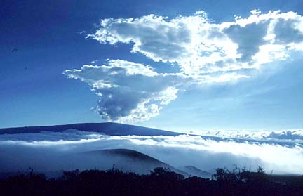
The Galapagos Islands, which led to many of Charles Darwin's theories of evolution, may now reveal what's going to happen with Hawaii's volcanoes. Faraway Galapagos
help scientists predict
Mauna Loa’s moodsStudies may link isle data to Mars volcanoes
By Helen Altonn
Star-Bulletin"Kilauea is well understood -- Mauna Loa not so much. That is our focus," said Falk Amelung, researcher in the University of Hawaii-Manoa's School of Ocean & Earth Science & Technology's Young Investigator program.
Although Mauna Loa is quiet, it is expected to erupt again. It's just a question of when, he said.
"What we hope to learn from the Galapagos is what happens before an eruption, so we will take measurements before eruptions and see what is the result of this activity, and it can be applied, hopefully, to Mauna Loa."
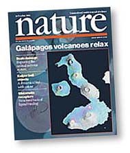
Amelung led a team that investigated Galapagos volcanoes with radar interferometry -- a technique using satellite data to produce high-resolution maps of displacements of the Earth's surface caused by volcanoes and earthquakes.Findings of the group, including Stanford University scientists Sigurjon Jonsson, Howard Zebker and Paul Segall, were published recently in Nature magazine.
Amelung, previously at Stanford, joined UH-Manoa last year primarily to use data from the university's satellite ground station on Sand Island to study Hawaii's volcanoes.
The Galapagos and Hawaii volcanoes both developed from hot spots in the Earth's mantle. But the Galapagos Islands are so remote -- about 600 miles west of Ecuador -- that little was known about their volcanoes, Amelung said.
Three big eruptions usually occur there within 10 years, he said. However, there were no previous ground-based measurements.
Kilauea, erupting continuously, has been well studied, with many ground measurements by the U.S. Geological Survey's Volcano Observatory. But Mauna Loa is so big, Amelung said, only a fraction is covered by the observatory.
A satellite launched in 1992 and a ground station in the Galapagos enabled the scientists to begin gathering data on volcanoes there.
But Hawaii had no ground station until 1998, when UH computer scientist Torben Nielsen led a project to establish one at Sand Island. Working with him was Peter Mouginis-Mark, who has been involved in planning NASA experiments with satellites and radar to study the Earth's surface.
"If you have two years of data, you can't do terribly much," Amelung said of the Hawaii satellite program. However, with eight years of data at the Galapagos, he said, "If we have just a small signal in Hawaii, it may help us to understand what it means."
Amelung said radar interferometry is similar to the technique used in NASA's Shuttle Radar Topography Mission in February.
"The satellite travels at 17,000 miles per hour and, even through clouds, can make accurate measurements within a quarter inch," he said.
"It's quite exciting because we can get these surface deformation maps for very remote areas, whereas before we could get measurements at certain points and this after days or weeks of travel."
Amelung's group discovered that accumulated magma in subsurface reservoirs in the Galapagos causes vertical displacements of the volcano's surface, or volcanic uplift, which often causes eruptions.
The team detected uplift at nearly all of the Western Galapagos volcanoes, indicating active magma reservoirs beneath.
But radar data from the Sierra Negra volcano, one of seven in the Galapagos, showed uplift doesn't always lead to eruption as scientists believed.
That is because of "trapdoor" faulting, a fracture system formed within the caldera. This might help to relax stresses above the magma chamber and prevent eruptions, Amelung said.
His work is part of continuing research by the Hawaii Institute of Geophysics and Planetology to study volcanoes worldwide with satellites.
Using the UH satellite ground station, the investigators are able to retrieve data from NASA, European and Japanese spacecraft.
NASA and the European Space Agency supported Amelung's program.
Volcanoes in the Galapagos Islands may yield clues about how volcanoes on Mars, as well as in Hawaii, might evolve. Studies may link isle
data to Mars volcanoes
Helen Altonn
Star-BulletinSeven University of Hawaii-Manoa scientists, plus staff members, are working on different aspects of Galapagos volcanoes.
That is "because they are so similar to Hawaiian volcanoes and because volcanoes made of this type of rock -- basalt -- are very similar to what we see in Martian volcanoes," said Peter Mouginis-Mark, Hawaii Institute of Geophysics and Planetology geologist and planetary scientist.
He said work being done by his institute colleague, Falk Amelung, in the Galapagos Islands "is really exciting because it shows how dynamic volcanoes can be, that they change almost on a month-by-month basis, sometimes without erupting."
This is intriguing, he said, because it indicates what the internal structure would be like for volcanoes.
He said the more satellite data Amelung processes, the better researchers will be at identifying topographic changes on the Big Island, which are hard to see because of heavy vegetation and moisture in the atmosphere.
Mouginis-Mark said he was interested in volcanic activity in the Galapagos Islands in 1998 that produced a big lava flow. He measured temperatures and volume change with shuttle experiments and Geostationary Environmental Satellite images.
Researchers Scott Rowland, Luke Flynn, Andrew Harris, Harold Garbeil and Eric Pilger also are mapping older flows, recent eruptions and temperature changes associated with eruptions.
"They are not all separate projects," Mouginis-Mark said. "Falk's project builds on others, also looking at eruptions in the same part of the world."
Part of their program compares the Galapagos and Hawaiian volcanoes to Mars in support of the Mars Global Surveyor mission, Mouginis-Mark said.
"Once we get results for the Earth, we can better interpret the data for the Mars Surveyor, which is collecting good images and topographic data for Martian volcanoes."