Advertisement - Click to support our sponsors.

A nearly three-month-long hydrographic survey of Hawaii's coastline using a state-of-the-art airborne laser will produce enough data to plan hurricane evacuation routes. Navy’s coastal surveys
to aid evacuation plansBy Gregg K. Kakesako
Star-BulletinMilton Yoshimoto, U.S. Army Corps of Engineers hurricane studies program manager, said the information gained from the charting and mapping survey of the shallow coastal waters of the populated areas of Oahu, Kauai, Molokai and the Big Island will be used to update comprehensive hurricane evacuation plans. The Maui survey was done in 1999.
Capt. Ty Aldinger, Pacific Fleets' oceanographer, added that having "a better model of the bottom of the ocean gives us a better idea how large of a wave will impact the islands."
The data obtained from the survey, which should be completed in about three weeks, Yoshimoto said, will be plugged into models that will show flooding zones. These surge studies will show how far a hurricane-generated wave will travel inland, what areas need to be evacuated and what emergency routes should be used.
The Navy and Corps of Engineers will make hurricane information available to state and county Civil Defense planners.
The hydrographic survey -- conducted by the Joint Airborne Lidar Bathymetry Center of Expertise -- is a partnership between the Naval Meteorology and Oceanography Command and the Army Corps of Engineers.
R.W. Pope, a scientist with the Naval Oceanographic Office, which is coordinating the survey, estimates the Navy's share of the survey is more than $1 million.
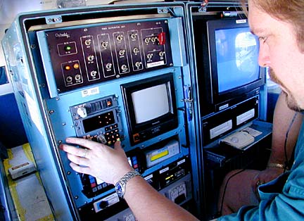
Pope said the survey employs the scanning hydrographic operational airborne Lidar survey system, where an airborne laser calculates the water's depths by measuring the time difference between the laser's reflection off the water surface and sea bottom.
Aldinger said that in the past, using boats and echo sounders, the same process would take years as compared to months with an airborne laser and would not cover as much area.
Also, there are areas where the seas are too rough to use boats, and those places would never be adequately charted, Aldinger said.
Using data gathered by the airborne lasers, the National Oceanographic and Atmospheric Administration will also be able to update navigational charts for Oahu, Molokai, Kauai and the Big Island during the next two years.
The Navy will use the information to produce charts for its training exercises and test areas. Maps of the island's coral reefs will be used by the U.S. Geological Survey to study their health and vitality.