Advertisement - Click to support our sponsors.

Hawaii scientist
eyes NASA launch
The isles' many volcanoes will
By Helen Altonn
help with a mission to map
Earth's topography
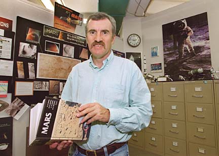
Star-BulletinUNIVERSITY of Hawaii scientist Peter Mouginis-Mark has done volcano research with NASA for more than 16 years -- and he still has many questions about eruptions.
He hopes some will be answered when the space shuttle Endeavour, scheduled to blast off from Cape Canaveral on Monday, carries equipment for a mission he and other scientists advocated: mapping nearly all of Earth's surface.
"We do not have the maps for all of the earth's surface like the shuttle will produce," said Mouginis-Mark, a planetary volcanologist and acting associate director of the Hawaii Institute of Geophysics and Planetology.
"This will increase our knowledge of the earth's topography by a considerable amount, particularly in places like Africa, Asia and South America."
The 11-day Shuttle Radar Topography Mission will use an advanced measurement technique called "radar interferometry." Two radar antennae will form the interferometer, with one of them placed on a 197-foot mast -- the largest fixed structure ever flown in space.
"It's going to look really spectacular," Mouginis-Mark said.
Hawaii will be a calibration target to help scientists understand how the radar system is measuring topography on volcanoes, he said. "We've done many experiments in Hawaii, so we can compare all the different data sets."
Mount Pinatubo in the Philippines also will be used as a calibration target for studying explosive volcanoes in Java and the Lesser Sunda Islands east of Java, Mouginis-Mark said.
"The reason we picked those volcanoes is, they are very poorly known in terms of their topography and the styles of eruption of the volcanoes," he said.
"So, it solves another piece in the puzzle that the UH volcano team is working on as far as understanding the types of volcanoes and eruptions that we have here on Earth."
Mouginis-Mark visited Pinatubo in May 1998 and led a research team there last November to collect more information on effects of the disastrous 1991 eruption. He is working with Stephen Self, a UH geology and geophysics professor, on Pinatubo's volcanic hazards.
Flooding caused by typhoons has eroded the volcanic material, turning the ash into mud flows that create severe hazards for people living downslope, he said.
The researchers will be looking at the topographic data to see how erosion is changing the volcano and if hazards after it rains can be minimized from the flows, called "lahars."
The UH scientists now use data from two NASA satellites: Terra, launched last month, and Landsat 7, launched last April.
Satellite data, and the information to be gathered by the shuttle, is valuable because it allows scientists to compare one part of Earth to another with the same measurement technique, Mouginis-Mark said.
For instance, he said there is only one topographic map of Hawaii.
"When we get the second one, we can use the computer to subtract one map from the other, and then in places like Kilauea where new lava flows have formed, this comparison lets us estimate the volume of new lava flows," he said.
"So we can tell where on the side of the volcano new lava flows have erupted and how much volume."
The U.S. Geological Survey does an excellent job in identifying new lava flows, Mouginis-Mark said, "but it's very hard to get a good number on the volume."
This is of interest, he said, because it provides a good measure of how Kilauea has been erupting over the years.
"As we get more and more of these topographic maps, we can monitor the volume of lava that Kilauea is erupting over a period of time," he explained. "That gives us an idea of what the internal plumbing system of the volcano is like."
A veteran of three earlier shuttle experiments, Mouginis-Mark said data gathered by the Endeavour will be valuable not only to Earth scientists -- whether studying volcanoes, glaciers or mountains -- but also to emergency relief planners, commercial companies and other investigators.
And UH researchers will use the shuttle's data for many other types of studies, he said. "It's going to be wonderful."
