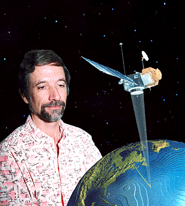
Photo illustration by Ken Ige, Star-Bulletin
"It's an extremely valuable tool... the nice thing is
it sees through clouds. —Jeff Polovina
Scientists develop
oceanic software
Honolulu researchers can
By Helen Altonn
now plot ocean features and track fish,
aiding harvesting
Star-BulletinHonolulu scientists have developed a way to track elusive fish in the ocean around the Hawaiian archipelago. The information could lead fishermen to bigger catches and help fishery managers preserve and build up resources.
"Maybe someday we'll put it on a Web page," said Jeff Polovina, ecosystem environmental investigations director at the National Marine Fisheries Service's Honolulu Laboratory. "A number of boats have computers."
A group led by Polovina developed software to make maps of ocean features similar to those of land topography with hills and valleys.
For the first time, he said, they're able to plot eddies, currents and other ocean features, monitor their changes and see how they affect fish movements.
They're using data from the Topex-Poseidon satellite, which measures the ocean's height within an inch.
Topex-Poseidon spins around Earth every 10 days covering the ocean, and the information is on the Internet within two days, Polovina said. "It's an extremely valuable tool ... The nice thing is it sees through clouds."
National Marine Fisheries Service's fishery biologist Don Kobayashi said, "We can basically do a new map every 10 days, and within these maps we're able to predict where things might end up, how features are moving."
Companies have approached the scientists for help in developing and using the research technology commercially, Polovina said.
Hawaii's long-line fishery has grown over five years into a $50 million-a-year operation, primarily for swordfish to the north and bigeye and yellowfin tuna around the Hawaiian Islands, he said.
But the ocean is "a petty barren place," Polovina said, explaining that the different features influence forage or food eaten by marine animals.
Kobayashi said the team is concentrating on use of the satellite data to understand the swordfish fishery in the northern part of the archipelago. "If swordfish are following areas of good food, that can also have an effect on where they'll end up."
The research vessel Townsend Cromwell is in swordfish grounds north of French Frigate Shoals with fishery biologist Mike Seki chasing eddies on the maps, Polovina said.
A subtropical front weakened in the swordfish grounds in 1994-95 but is stronger now, he said. "We can see these features and send them out to look at what's going on in the whole water column." Until now, he said, "there was no way to know if you were sitting in the middle of one of these things."
Measurements below the ocean surface and information collected on plankton and other sea life will help his group calibrate calculations of currents and interpret the features, he said. The researchers also are getting a better picture of circulation around the Hawaiian Islands and the impact on larvae distribution, Polovina said.
For a long time, for instance, they wondered about lobsters, he said. "Where do larvae go? Are they swept away?" The larvae float around for one year in the ocean, so the pattern of currents is important, he said.
The group used satellite data for a computer simulation program to show where the larvae would end up in a year after leaving Maro Reef and Necker Island.
Those from Necker never made it to the northerly reef, but the ones from Maro went to Necker, Polovina said. Larvae from both places reached Oahu.
The information is valuable for fisheries management because it indicates some islands could be harvested heavily while others, with little larvae, may take a long time to rebound, he said.
The scientists are also applying the data to study the range of turtles, sharks, tunas, swordfish and other animals, where they go to eat, whether the fishery is changing because of habitat variabilities and if there is overfishing, Polovina said.